 Halfway through our group exploration weeks, this week focused on Explore: Tracking, and offered a chance for the students to research all of our options in terms of making sure we could find the payload after it lands — including where the balloon was during flight, where it was likely to land. After discussing the key issues briefly in the class as a whole, we again divided into five random groups of five students each, and each group went off to explore our options.
Given that we were planning to attach hundreds of dollars worth of camera equipment to a weather balloon and letting it go, we wanted to be sure we had all of our bases covered in terms of being able to locate our payload. They researched how GPS systems worked, and explored options for using cellular, satellite, and amateur radio systems to track our balloon. The challenge is that while all of these systems use the same GPS satellites to determine their location, they all use different technologies to tell us where they are.
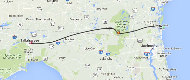 In addition, the students studied several different simulations for tracking weather balloons, and determined that depending on the weather, we were very likely to have our balloon land in the Okefenokee National Wildlife Refuge in Southern Georgia (in a worst case scenario, the balloon would pop over the swamp, and land in the Atlantic Ocean). Given the lack of cellular coverage in this area, this made it essential that we use a tracking system that does not depend on cellular networks. We also discussed the need for us to have a handheld GPS system that we could take into the woods with us, as we were very likely to have to go “off grid” as we tracked down the last known coordinates of our payload. At the end of the week, each group handed in notes detailing how best to proceed in terms of keeping track of our payload throughout the launch process.